Master Redevelopment Plan
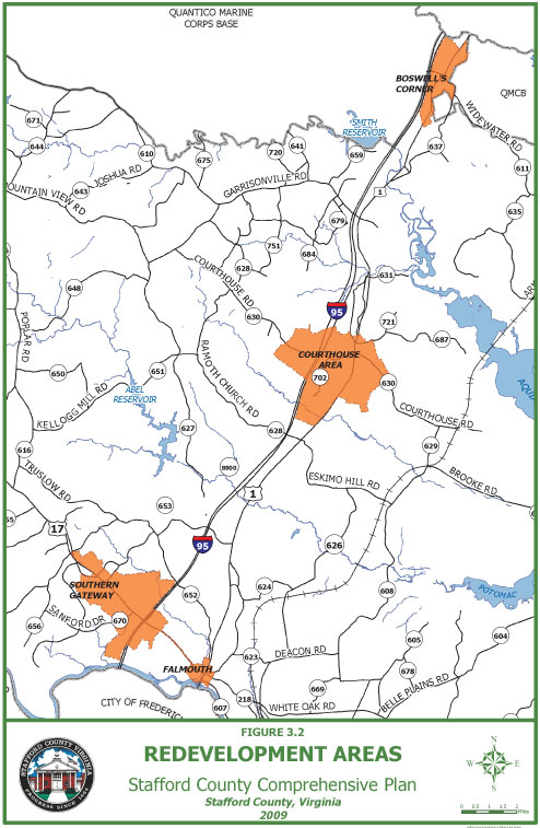
The Stafford County Board of Supervisors has adopted a Master Redevelopment Plan as an economic development element of the Comprehensive Plan. The Plan identifies four areas that offer unique opportunities for development – Boswell’s Corner, Courthouse Area, Falmouth Village, and the Southern Gateway.
As the region’s population grows, Stafford officials believe that the redevelopment areas provide unique opportunities for businesses and recreation. As such, County leaders are encouraging development in these areas through private sector investment and partnership by providing a framework for improvements over time. These changes will provide a more sustainable economic future for these areas.
The following links include information on each of the redevelopment areas. Each section provides a visioning document depicting what could be created in each of the targeted areas. The Board of Supervisors adopted these visions following unprecedented public involvement. The ultimate goal is to spur economic growth by encouraging an opportunity to create a positive initial impression for visitors, and an inviting pedestrian environment for workers. Through public-private partnerships, space for vibrant commercial development can be provided to create 21st Century business community anchors for Stafford County in each redevelopment area.
Boswell’s Corner
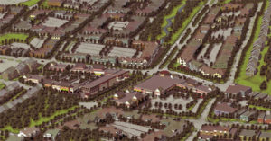
The intersection of Jefferson Davis Highway (US-1) and Telegraph Road (VA-637) marks where the major north-south and east-west roads (respectively) meet. These already existing roads serve as a natural location for mixed-use opportunities.
Vision
This vision will spur concentrated economic growth by encouraging an opportunity to create a positive initial impression to visitors, and an inviting pedestrian environment for workers in this “employment center” location. Through public-private partnerships, this vision will provide necessary space for commercial development and create a vibrant business community anchor for Stafford County.
Opportunity
Boswell’s Corner is an economic opportunity area in north Stafford County, located along Jefferson Davis Highway, adjacent to Marine Corps Base Quantico (MCBQ) and I-95, and about one mile south of the National Museum of the Marine Corps. Recent personnel growth at MCBQ, including redeployments mandated by the 2005 Base Realignment and Closure (BRAC) Commission Report and the corresponding growth in the defense contractor network supporting the Base, continues to increase the demand for commercial and office space in the area. The 2005 BRAC actions precipitated the consolidation and relocation of the Military Defense Investigative Agencies and its nearly 3,000 personnel, and the subsequent construction of the new 700,000 square-foot Russell-Knox office building on Quantico. This and other recent growth in daytime population in the Boswell’s Corner area, provide for a number of economic development opportunities.
Potential
Currently, Boswell’s Corner is an underutilized area with sparse and varied businesses and vacant lots. This condition has the potential to support needed commercial growth; however, in an unplanned environment, such anticipated and intense development at Boswell’s Corner could occur in a haphazard manner resulting in isolated or fragmented development. To facilitate private-sector investment, the Stafford County Board of Supervisors has enacted form-based code land development regulations for the area. This RDA-1 zoning district is available to interested developers through the County’s rezoning process. RDA-1 zoning offers more flexibility than traditional zoning. Click here for additional information on RDA-1 zoning. One corporate campus – Quantico Corporate Center – is already underway to accommodate the needs of the relocating government contractors and other support businesses. Visit the Quantico Corporate Center website for more details.
Courthouse Area
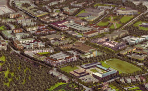
Cultural, civic, work, shop, living and recreational areas must be woven together with parks and streets to create a walkable and memorable Town of Stafford, the seat of the County Government.
Opportunity
The Courthouse Area encompasses the Stafford Courthouse, County Government buildings — including the Ford T. Humphrey Public Safety building, Stafford Hospital Center, and an eclectic mix of offices, shops, and homes. The Stafford Hospital Center, opened since 2009, has brought additional employees and visitors to the area and continues to expand. A new interchange is planned at Exit 140, off I-95, which will make access easier to this concentration of activity.
Potential
The Courthouse area includes the intersection of Jefferson Davis Highway (US Route 1) and Courthouse Road (Rt. 630). Free-standing retail and office buildings, generally supporting government activities, have evolved here. Aside from providing primary access to the County Administration Building, Courthouse Road connects Jefferson Davis Highway to I-95. The new projects and proposed interchange bring the potential for reinvestment.
Falmouth Village
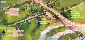
Aerial rendering of Falmouth Village redevelopment area.
Vision
The Village of Falmouth stands at a decision-making crossroad. Poised at the busy intersection of two major US highways, the impacts of highway upgrades upon the character and environment of this fragile historic place will need to be considered and understood. Sixty years ago, the village was split into two geographically isolated neighborhoods when the Jefferson Davis Highway (US Route 1) bridge (over the Rappahannock River) was constructed, connecting Stafford County and the City of Fredericksburg. Plans are now being developed to upgrade the intersection of Jefferson Davis Highway and Warrenton Road (US Route 17).
Opportunity
Currently, Falmouth is divided into four distinct areas by the existing major highway network. Jefferson Davis Highway bisects Falmouth into western and eastern halves, and Warrenton Road bisects the western and eastern halves into northern and southern quadrants. Through sensitive new infill development in the village center, protection of the existing natural surroundings of the village, and improved access to the river, Falmouth will become a key link in the Heritage Loop that looks to celebrate and conserve the County’s natural resources and historic treasures.
Potential
Falmouth Village, established in the early 1700s, presents a unique opportunity to celebrate, redefine and improve a significant historic place in Stafford County. As decisions are made related to future potential highway infrastructure, they must be done in a context that considers the future of Falmouth Village. The vision for Falmouth proposes to build upon Falmouth’s past, as well as its natural resources to attract heritage tourism.
View the Falmouth Village master redevelopment plan
Project Status
1st Quarter 2016 Update
- Improvements to the intersection of US Route 1/US Route 17 Business/Butler Road. Click here for additional information.
- The Board of Supervisors recently initiated the rezoning of the Counting House from residential to commercial. The request was approved by the Planning Commission on February 10, 2016. A public townhall meeting has been organized by both Board of Supervisors members from this area and will take place on February 18th, 7:00pm-9:00pm at the Falmouth Elementary School. The Counting House is owned by the County and it is located at 103 Gordon Street (Stafford County Tax Map Parcel No. 53D-1-36; Virginia Department of Historic Resources [DHR] #089-0067-0006). It is a circa 1840s dwelling that has been determined to be individually eligible for the National Register of Historic Places (NRHP) and is also located within the NRHP-eligible Falmouth Historic District (DHR #089-0067). Over its lifetime, the Counting House has been used for a variety of uses, both residential and non-residential. The Redevelopment Plan encourages reuse of properties in this area in a manner consistent with the character of and compatible with existing uses. The County is working to return the Counting House to private ownership and they are currently negotiating with a small business owner. Click here for additional information.
Southern Gateway
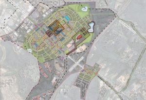
Master plan and core development area
Opportunity
The Southern Gateway area is located adjacent to Warrenton Road (US Route 17) between the Falmouth Redevelopment Area and Berea Road. Warrenton Road is a highway of national significance, used by traffic traveling from the Northern and Midwestern States and Canada, to the Southeastern States. It is also a preferred alternative route for vehicles seeking to avoid the Washington, DC Capital Beltway. As traffic on Warrenton Road has continued to grow, so has private investment. Two major initiatives are now underway — Celebrate Virginia North, a 2400-acre mixed-use development, and Carter’s Crossing, a 35-acre retail center.
Potential
Currently, since Warrenton Road is not a limited access roadway like an interstate, it also serves adjacent commercial and industrial developments through driveways and side roads. The frequent access to adjoining properties is necessary because each of the parcels house stand-alone commercial uses. Since there are no roads paralleling Warrenton Road, this mixing of local and through-traffic, interrupted by stoplights, adds to the congestion already present as traffic waits to enter southbound Interstate 95.
An incremental approach to redevelopment will allow a measured pace of improvement to the quality of life for the thousands of Stafford County residents in the surrounding area. The redevelopment pattern focuses on compact, mixed-use neighborhoods with access to new civic and cultural uses, shopping, work, and public green space. A grid-based local street system is proposed to serve the neighborhoods, thereby allowing nearby residents to focus away from Warrenton Road. Access would be redesigned to take advantage of the benefits of the local grid network.
View the Southern Gateway master redevelopment plan
Project Status
1st Quarter 2016 Update
- Improvements to US Route 17 west of Interstate 95. Click here for additional information.
Aquia Town Center
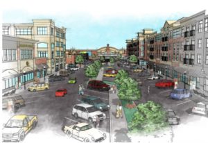
OPENING SPRING 2017! After its transformation, the Aquia Town Center will feature upscale office suites, multi-family residences, popular retail destinations and exciting restaurants.
OPENING SPRING 2017! After its transformation, the Aquia Town Center will feature upscale office suites, multi-family residences, popular retail destinations and exciting restaurants.
Mosaic Realty Partners has Aquia Town Center as their highest priority.
Mosaic, a MD-based development firm, have done their due diligence and have submitted a site plan for 160,000 sf of commercial redevelopment just east of I-95 at Exit 143.
Mosaic Realty Partners purchased Aquia Town Center (“Aquia”), a 25-acre development site off the I-95 interchange at Garrisonville Road (State Route 610) in Stafford County, Virginia. This I-95 exit is the southern terminus of the recently complete express lanes. Mosaic will develop 160,000 square feet of retail space with a 70,000 square foot grocery store anchor.
“The county’s focus on infrastructure, schools, parks, public safety and the AAA Bond Rating, clued us in that this was a great place to do business….we have had very good engagement with the county staff and are eager to strike a balance between an ambition plan – and the ability to get it accomplished.” – Eron Sodie
The first half of the project is scheduled to be completed by 2017. SEE VIDEO
Adjoining the commercial property is 256-unit Class A, multifamily project developed by Franklin-Johnson.
For additional information, visit Mosaic Realty Partner’s website.
For all retail leasing inquiries, please contact Kirk Cheney with KLNB Retail at 703-722-2727 [email protected]

